Parts of the north-eastern United States and southern Spain have been hit by contrasting bouts of extreme weather this week, bringing an early taste of winter to New York and destructive winds to the Costa del Sol.
New York's Early Winter Blanket
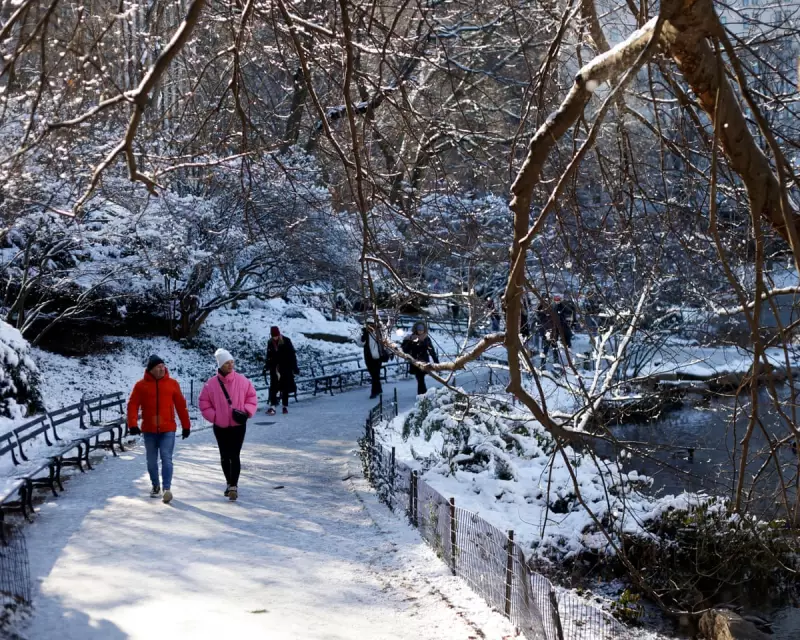
A plunge of bitterly cold air from Canada set the stage for the earliest snowfall in New York since 2018. The city's iconic Central Park was dusted with several centimetres of snow on 15 December, transforming it into a winter scene as captured by photographer Deccio Serrano.
The weather system proved even more potent further east. Long Island received a substantial 21cm (8.5 inches) of snow, causing disruption and creating a picturesque, if premature, winter landscape. This event stood in contrast to conditions just weeks prior, when a low-pressure system tracked north of the city, allowing warmer air to prevail and sparing New York widespread snow while coating upstate areas.
This week's synoptic picture was distinctly different. With the frigid air firmly entrenched over the region, any precipitation generated by an eastward-tracking low-pressure system fell unequivocally as snow.
Storm Emilia's Destructive Twist in Spain
While New York shivered, southern Spain was grappling with the fury of Storm Emilia. In a dramatic and hyper-localised event, a tornado touched down in the early hours of Tuesday in the seaside town of La Cala de Mijas, near Málaga.
The tornado, accompanied by heavy rain, wreaked havoc along the main high street. Its most symbolic casualty was the town's elaborate Christmas light display. Festive decorations valued at £67,000 were torn down by the violent winds. Initial estimates suggest the storm caused total damages approaching £500,000.
The Science Behind the Spanish Tornado
Meteorologists explain that the tornado formed through a specific atmospheric process. Warm, moist air rose while colder, drier air sank. A phenomenon known as wind shear—where wind speed and direction change with altitude—created an invisible, horizontal tube of rotating air.
This tube was then lifted and tilted vertically by updrafts from the rising moist air, forming a rotating mesocyclone within the storm. Downdrafts of cold air then wrapped around this column, intensifying and focusing the rotation downward to ground level. This created localised wind gusts estimated at 80mph (130km/h), powerful enough to lift debris and destroy the festive installations, while areas just outside the tornado's path experienced far less severe conditions.
These concurrent events on both sides of the Atlantic underscore the powerful and varied impacts of seasonal weather systems, from delivering a postcard-perfect snowfall to unleashing sudden, costly destruction.


