
Iberian Peninsula Gripped by Severe Weather Crisis
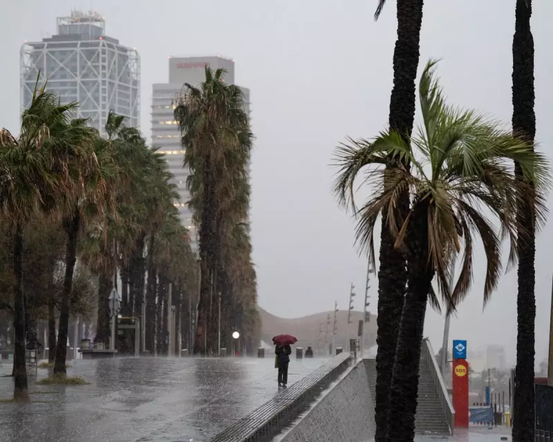
Spain faced a dramatic weather emergency this week as violent thunderstorms and torrential rains swept across the country, causing significant disruption and damage. The severe conditions prompted Spain's meteorological service, Aemet, to issue orange weather warnings across extensive regions.
Meteorological Origins of the Storm System
The extreme weather developed from a deep area of low pressure situated in the Atlantic Ocean, northwest of Spain. This system reached an exceptionally low central pressure of 989hPa, driving a cold front eastward across the Iberian peninsula that triggered the severe thunderstorms.
Heavy rainfall proved particularly problematic, with over 30mm falling within 24 hours across Galicia. More localised areas experienced even higher totals, reaching 60mm in some locations, resulting in surface flooding that overwhelmed drainage systems.

Widespread Impact and Damage Reports
The town of Cáceres in Castilla y León recorded 50mm of rainfall in 24 hours, with subsequent flooding rendering numerous roads completely impassable. Emergency services worked to manage the situation as water levels rose rapidly.
Southern Spain experienced particularly dramatic conditions, including reports of large hail stones. The most remarkable measurement came from Cádiz in Andalucía, where a hailstone measuring 6cm in diameter was documented - an unusually large size that can cause significant property damage.
Powerful winds compounded the problems, especially along Spain's northern coastline where gusts of 55mph were widely recorded. More extreme measurements included localised gusts reaching 65mph, with the most dramatic reading coming from Ouria in Asturias, where a wind gust of 99mph was reported.
Global Weather Extremes Continue
Meanwhile, other parts of Europe faced similar challenges. The Greek island of Skiathos received more than 60mm of rainfall on Wednesday, leading to severe flooding there as well. Meteorologists attributed this event to an upper air cut-off low, a weather pattern known for generating heavy precipitation.
In southeast Asia, Typhoon Kalmaegi (also known as Tino) brought devastation to the Philippines and Vietnam. Forming on October 31st in the western Pacific, the cyclone made landfall in the Philippines with strength equivalent to a category 2 hurricane, producing winds of approximately 80mph.
The typhoon's impact proved severe, with flash flooding sweeping away vehicles and riverside homes. Official reports confirmed 188 fatalities with 135 people still missing, while approximately 500,000 residents were displaced from their homes.
After crossing the Philippines, Kalmaegi moved westward across the South China Sea toward Vietnam. Despite initial weakening, the storm regained strength before making landfall on Thursday with the intensity of a category 3 hurricane, generating winds up to 93mph and waves reaching 10 metres high.
The Vietnamese impact included widespread flooding, power outages, uprooted trees, structural damage to buildings, and one confirmed fatality from a house collapse. Authorities had evacuated approximately 260,000 people in preparation for the storm's arrival.
These concurrent extreme weather events across different continents highlight the increasing frequency and intensity of severe meteorological phenomena affecting populated regions worldwide.


