
Tropical Cyclone Narelle Intensifies as It Approaches Australian Coast
The Bureau of Meteorology has issued urgent warnings as Tropical Cyclone Narelle tracks toward the Queensland coast with potentially devastating force. The storm, which intensified to a category-five system over the Coral Sea, is expected to make landfall as a category-four cyclone on Friday morning.
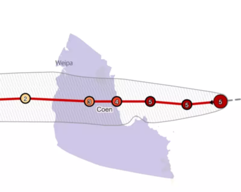
Forecasted Path and Impact Timeline
Current tracking maps show Narelle's expected path will bring it ashore in far north Queensland, with the system then continuing across the Gulf of Carpentaria toward the Northern Territory in subsequent days. The cyclone is forecast to hit with wind speeds reaching up to 225 kilometers per hour (140 miles per hour), bringing destructive wind gusts that could cause significant damage to infrastructure and property.
Queensland Premier David Crisafulli addressed reporters on Thursday, emphasizing the seriousness of the approaching system. "This is a serious system though, and I'm asking people to take it seriously," Crisafulli stated. "Because it is the kind of event that doesn't happen all that often."

Historical Context and Potential Damage
The premier noted the rarity of such powerful cyclones, explaining that if Narelle crosses the coast as a category-five system, it would mark only the fourth occurrence in fifty years. "I can't sugar-coat this," Crisafulli warned. "The damage will be widespread."
Beyond the extreme winds, the cyclone threatens multiple hazards including:
- Heavy rainfall leading to flash flooding
- Dangerous storm surges along coastal areas
- Potential for widespread power outages
- Significant disruption to transportation and essential services
Community Preparedness and Official Response
Authorities have urged residents in the projected path to complete emergency preparations immediately. While acknowledging the resilience of Queensland communities that have faced similar threats before, officials stress that this particular system demands exceptional caution.
"I know these communities are resilient and they've been here before and they know what wind and a lot of rain looks like," Crisafulli said, while still emphasizing the need for vigilance.
Tracking maps will be updated periodically with the latest forecast information as the cyclone approaches. Residents are advised to monitor official channels for evacuation orders and safety instructions as the situation develops.


