
Residents across Florida have received an unusual weather warning to beware of iguanas plummeting from trees as an unprecedented Arctic cold snap grips the eastern United States.
Frozen Reptiles Pose Unusual Hazard
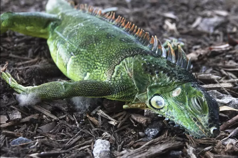
The National Weather Service has issued alerts across Florida's northern third, extending as far south as Gainesville, where temperatures are predicted to drop low enough to cause iguanas to become paralysed and fall from branches. Weather experts confirm the reptiles become sluggish when temperatures fall below 50°F and can completely shut down when thermometers drop below 40°F.
This isn't just theoretical - in January 2023, a man participating in an outdoor yoga session in Miami was actually struck and injured by a falling iguana. The current cold snap represents a genuine safety concern for residents spending time outdoors.

Record-Breaking Early Winter Storm
The iguana warning comes as one of the season's first major winter systems takes hold across the eastern two-thirds of the United States, stretching from the Great Lakes region all the way to Florida and Texas. Meteorologists describe this as an unusually early and extensive blast of Arctic air from Canada that's breaking records for November.
Chad Merrill, AccuWeather's senior meteorologist, explained on their website: "This storm pattern will introduce some of the coldest air seen for early November and that is the reason for the robust snow amounts expected in the Great Lakes and the far southern extent of the flurries into the southern Appalachians."
The National Weather Service confirmed temperatures would "tie or break many records across the south-east" through Monday night, with the Arctic air mass affecting nearly the entire eastern two-thirds of the country.
Northern States Face Heavy Snowfall
While Florida deals with falling reptiles, northern states are confronting significant winter weather. Heavy snow continues to fall around Lake Michigan, with winter storm warnings cautioning about wind gusts reaching 30mph combined with up to 18 inches of precipitation, creating the dramatic phenomenon known as thundersnow.
By Monday morning, some midwestern areas had already received over a foot of snow. Residents of Illinois, Michigan, Indiana and Wisconsin were forecast to experience the worst conditions, with cold weather warnings also issued in Ohio, West Virginia and Kentucky.
The timing is particularly unusual - as Merrill noted, "For some of the major metro areas this snow is coming way earlier than average. Chicago O'Hare, on average, often records the first inch of snowfall accumulation on 17 January."
Some of the earliest snow on record was observed in Asheville, North Carolina, while early freezes were expected across numerous southern states from Texas and Oklahoma to Alabama and Georgia.
The good news according to forecasters is that by Tuesday night, the lake-effect snow should begin to wind down, with the bitter cold air retreating northward and milder conditions spreading east from the Great Plains.


