
Ex-Cyclone Narelle Triggers Flood Warnings Across Northern Territory
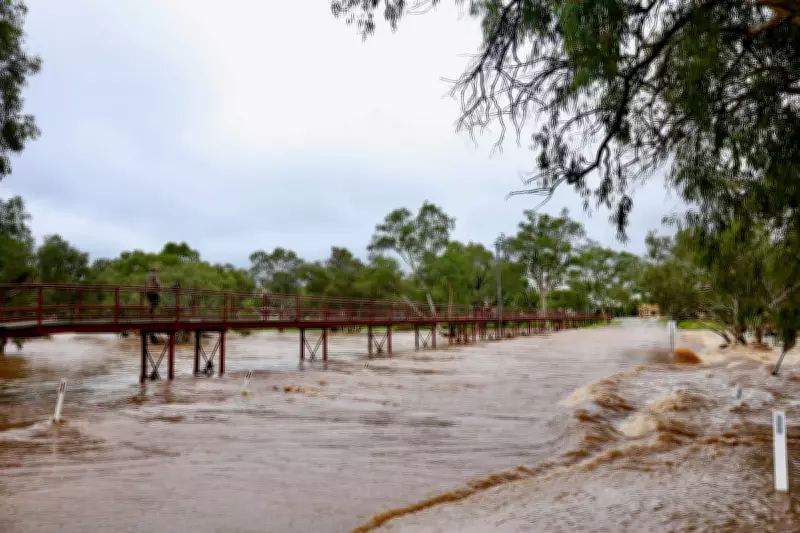
Communities in Australia's Northern Territory are facing significant flood threats as ex-Tropical Cyclone Narelle continues its westward trajectory across the continent. The system has already delivered more than 100 millimeters of rainfall to saturated regions, prompting urgent alerts for several areas including Daly River, Adelaide River, and Katherine.
Storm System Expected to Regain Strength Over Indian Ocean
According to the Bureau of Meteorology, Narelle weakened to a tropical low on Monday after impacting the Northern Territory over the weekend. However, forecast models indicate the system will move into the Indian Ocean by Tuesday evening and travel south parallel to Western Australia's coastline. Meteorologists predict it will regain strength, potentially developing into a severe tropical cyclone by Wednesday evening.
Ilana Cherny, a meteorologist at the Bureau of Meteorology, explained the system's projected path. "It's going to spend significant time over water and will move into a favourable environment to re-intensify into a tropical cyclone and then a severe tropical cyclone," she stated. By Thursday, Narelle could become a major category four system offshore, bringing damaging winds to coastal areas.

Potential Weekend Threat to Perth Region
The unusual aspect of this weather event is Narelle's potential to impact southern Western Australia. Cherny noted that by Friday, the system is likely to track further south toward WA's central and southern parts, with possible coastal crossing scenarios over the weekend. "This far out we are seeing a range of scenarios and a system coming towards the coast through a range of locations through central and southern parts," she cautioned.
Northern Territory Chief Minister Lia Finocchiaro expressed relief that the system was moving toward Western Australia but acknowledged the significant rainfall it had already delivered. "As we are all very relieved to learn, ex-Tropical Cyclone Narelle is now very close to the West Australian border and we bid her farewell, and hope that everyone in WA will be OK," she said on Monday morning.
Historical Context and Climate Factors
Dr. Hamish Ramsay, a climate and cyclone expert at CSIRO, highlighted the rarity of this event. "The last tropical cyclone to cross Australia east to west was Steve in 2000, so [Narelle] is a relatively rare event," he explained. "Most tropical cyclones weaken over land but can persist as tropical lows for days. If the low eventually re-emerges over warm ocean waters, it can quickly regain strength."
Climate scientists have pointed to record ocean temperatures as a contributing factor to Narelle's initial formation and strength. The system formed south of Solomon Islands in the Coral Sea last Tuesday, with current forecasts suggesting it could travel at least 5,000 kilometers across the continent.
Immediate Impacts and Infrastructure Disruption
The heavy rainfall has already caused significant disruption in the Northern Territory. Several roads have been closed, including sections of the main Stuart Highway near Adelaide River. River systems throughout the region are rising rapidly, with the Todd River in Alice Springs visibly swollen and the Katherine River being closely monitored by anxious residents.
As the system moves into Western Australia's northern Kimberley region on Monday afternoon, it is expected to bring damaging gale force winds with gusts up to 100 kilometers per hour, along with heavy rain that creates risks of both riverine and flash flooding.
While the potential threat to Perth and southern Western Australia remains uncertain, meteorologists note there is historical precedent for cyclones impacting southern regions. Cyclone Alby brought strong winds to WA's south-west in 1978, and the remnants of Cyclone Ned made landfall just south of Perth in 1989. More recently, Severe Cyclone Seroja crossed the coast north of Geraldton in 2021.
The unusual trajectory of ex-Tropical Cyclone Narelle continues to challenge forecasting models while raising concerns about both immediate flooding dangers and potential weekend impacts on Western Australia's population centers.


