Cold Weather Health Alert Activated Across England as Met Office Issues Snow and Ice Warnings
A significant four-day cold weather health alert has been officially initiated across central and northern regions of England, with the UK Health Security Agency (UKHSA) warning of potential risks to vulnerable individuals. The alert, which remains active until 8am on Monday, coincides with Met Office warnings for snow and ice across substantial portions of the United Kingdom.
Met Office Issues Yellow Warning for Snow and Ice
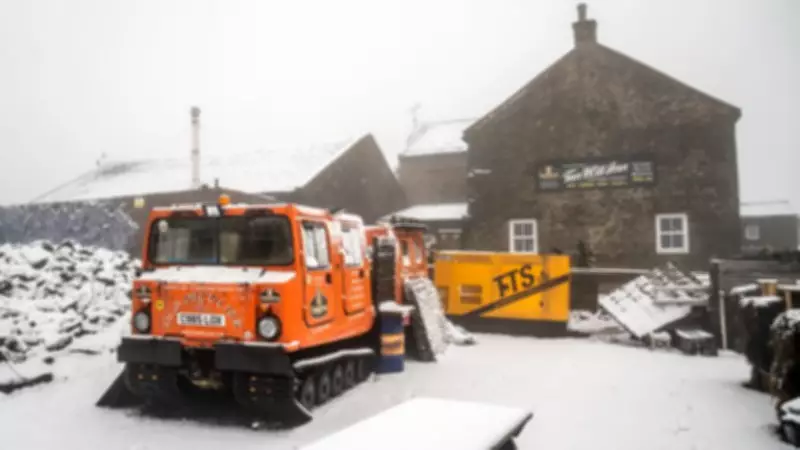
The Met Office has confirmed that an Arctic maritime air mass has ushered in considerably colder conditions, prompting the issuance of a yellow weather warning for snow and ice. This warning remains in effect until noon on Friday and encompasses virtually the entirety of Scotland alongside most of northern England. Forecasters indicate that higher ground areas may experience accumulations of snow upon waking.
"Locations above 200 metres in Scotland and northern England may see 2-5cm of snow, but those locations above 300 metres may see double those amounts, up to 10cm," stated Met Office chief forecaster Jason Kelly, highlighting the elevation-dependent nature of the snowfall.

Health Services Brace for Increased Demand
The UKHSA's health alert specifically warns that vulnerable populations, including the elderly and those with pre-existing health conditions, could face heightened risks during this cold spell. The agency also anticipates possible "minor impacts" on health services due to an expected surge in demand for medical assistance related to the adverse weather conditions.
This alert system is designed to proactively inform the public and health providers, enabling better preparation and response to weather-related health threats.
A Brief Respite in Gloomy Weather Patterns
The onset of this cold snap follows an exceptionally wet start to the year 2026. The Met Office reported that a persistent "blocking pattern" of weather led to record-breaking rainfall, with 26 weather stations setting new monthly records for January. Notably, Northern Ireland experienced its wettest January in 149 years.
However, a temporary shift is expected. Friday is forecast to bring some sunny spells to southern areas, though rain is anticipated across the Midlands and Wales. Saturday promises colder conditions with a widespread morning frost, where temperatures may struggle to rise above zero. Despite the chill, it will be markedly brighter and drier than recent weeks, potentially marking the first entirely dry day of the year for some regions. Daytime highs are expected to reach approximately 4-6C (39-43F) under sunny skies for much of the UK.
Unsettled Conditions to Return
This period of drier, brighter weather is projected to be short-lived. The Met Office forecasts that a new weather front will sweep in from the west on Sunday, bringing a return of rain, strong winds, and further snowfall to northern areas. This indicates a quick return to the unsettled conditions that have characterized the early part of the year.
Authorities are urging the public, especially those in alert areas, to stay informed through official weather forecasts, take necessary precautions against the cold, and check on vulnerable neighbours and relatives during this period of heightened meteorological and health concern.