A dramatic and dangerous shift in weather patterns is unfolding across the United States, bringing a sudden and severe end to a spell of record-breaking warmth. Millions of Americans are swapping summer attire for winter coats as a surge of Arctic air sweeps southwards.
From Spring-like Bliss to Winter's Bite
Last weekend, an extraordinary meteorological setup delivered unseasonable heat to the southern and midwestern states. A low-pressure system in the western US drew warm, humid air north from the Gulf of Mexico, causing temperatures to soar an incredible 15-20C above the late December average. This created spring-like conditions, with many experiencing weather more typical of April than the festive season.
However, the pattern has now decisively flipped. A ridge of high pressure building in the west is acting as a gateway, allowing a frigid polar airmass to dive deep into the continent. This surge of cold air is sweeping away the recent warmth, bringing a widespread risk of freezing conditions and snow to many of the same areas that were basking just days ago.
Global Extremes: Heat, Snow and Storms
The remarkable temperatures were not isolated to North America. In South America, São Paulo, Brazil, recorded a maximum temperature of 36.2C, its highest December reading on record. The heat is expected to persist early this week, spreading into parts of Chile and Argentina.
Across the Pacific, winter has taken a firm and deadly hold in Japan. Severe weather, including heavy snow and ice, caused a catastrophic pile-up on a motorway in Minakami, Gunma prefecture last Friday. The incident left two people dead and dozens injured. Further heavy snow is forecast, driven by a phenomenon known as 'sea-effect' snow. This occurs when bitterly cold westerly winds from Siberia blow across the warmer Sea of Japan, picking up moisture that dumps as snow on northern and western regions.
Southern Hemisphere Summer Severity
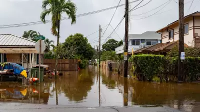
While the Northern Hemisphere contends with winter extremes, the summer season in the Southern Hemisphere is also turning volatile. Parts of New Zealand's South Island have been hammered by severe summer storms featuring torrential rain, large hail, and frequent lightning. Travel has been severely disrupted, with the Canterbury Plains experiencing a rare and powerful 'supercell' storm.
The severe weather is set to continue. Forecasters anticipate an area of low pressure will move over the North Island, bringing strong winds and exceptionally high rainfall. Western parts could see totals of 100mm, with some areas potentially receiving up to 200mm, raising concerns of flooding and further disruption.
This week of global weather extremes underscores the powerful and often unpredictable forces that shape our climate, delivering starkly different challenges to communities around the world.


