Winter Storm Brings Bucharest to a Standstill with Record Snowfall
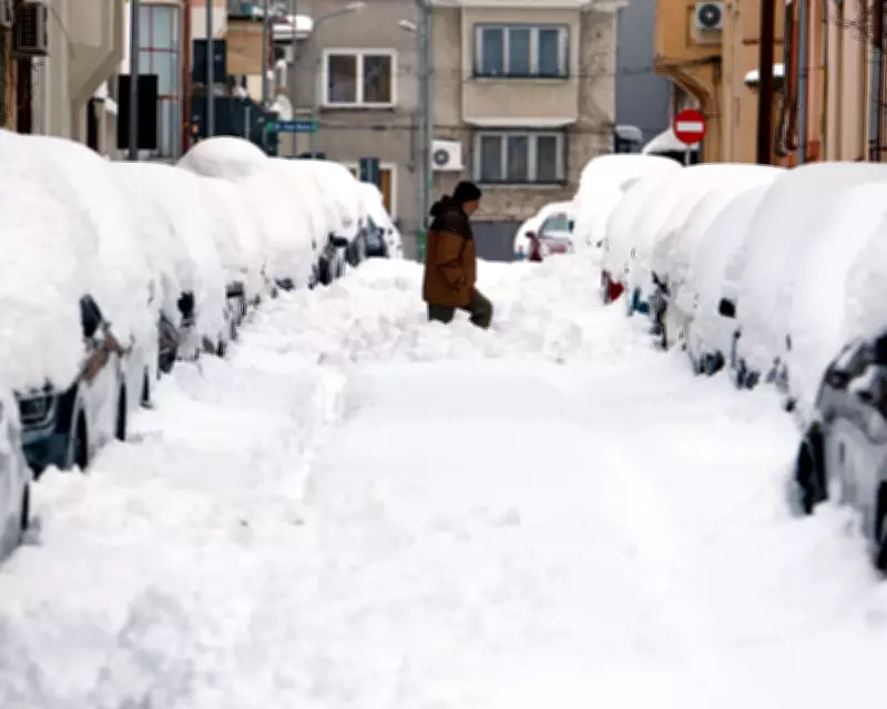
A powerful winter storm has unleashed chaos across Romania, particularly in the capital city of Bucharest, where more than 40 centimeters of snow blanketed the streets this week. This accumulation dramatically exceeds the February average of just 11 centimeters, plunging the southeastern region into a state of emergency as blizzard conditions prevailed.
Transport Networks Paralyzed and Power Outages Widespread
The heavy snowfall severely disrupted public transportation systems throughout Bucharest. International airports were forced to close their runways, while train services experienced delays stretching up to six hours. Major motorways and key routes into the capital became impassable, leading to significant traffic gridlock.
Compounding the crisis, the weight of the snow brought down hundreds of trees and numerous power lines across affected areas. These incidents resulted in widespread electricity failures, leaving approximately 200,000 homes without power as utility crews struggled to restore services amid the challenging conditions.
France Grapples with Relentless Flooding from Sequential Storms
Meanwhile, in southwestern France, a persistently wet winter continues to wreak havoc as Storm Pedro followed closely behind Storm Nils. This consecutive barrage has exacerbated existing flooding issues, with Storm Nils having already claimed two lives last week due to powerful winds and severe inundation.
Although Storm Pedro proved less intense than some recent weather systems, it still delivered wind gusts exceeding 70 miles per hour and dumped an additional 50 millimeters of rainfall in certain locations. This precipitation arrives during a record-breaking wet period for France, where soil moisture levels have reached their highest recorded point since measurements began in 1959.
Extended Flood Alerts and Anticipated Relief
French authorities have maintained orange or red flood alerts—the two highest warning levels—for more than thirty consecutive days as rivers remain dangerously swollen. The saturated ground simply cannot absorb further rainfall, transforming what would typically be manageable precipitation into destructive flooding events.
Meteorological relief appears imminent, however, as high-pressure systems are forecast to build across the region next week. This atmospheric shift should halt most rainfall for at least several days, providing much-needed respite for the worst-affected communities and allowing floodwaters to gradually recede.
Unseasonable Warmth Sparks Wildfires in Central United States
In a contrasting weather phenomenon, much of the central and eastern United States experienced temperatures 10 to 15 degrees Celsius above seasonal norms earlier this week. This unseasonable warmth provided millions of Americans with an early taste of spring, particularly in Chicago, Illinois, where thermometers soared above 18 degrees Celsius on Monday.
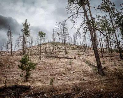
However, these elevated temperatures combined with dry conditions and gusty winds to fuel fast-moving wildfires across parts of Colorado, Kansas, and Oklahoma. These blazes consumed tens of thousands of acres of land, threatening properties and natural habitats.
The dangerous wind conditions also contributed to a tragic 30-vehicle pileup in Pueblo, Colorado, where gusts over 60 miles per hour created "brown out" conditions by kicking up dust and dirt that dramatically reduced visibility. This catastrophic collision resulted in five fatalities, underscoring the severe risks associated with such extreme weather patterns.


